









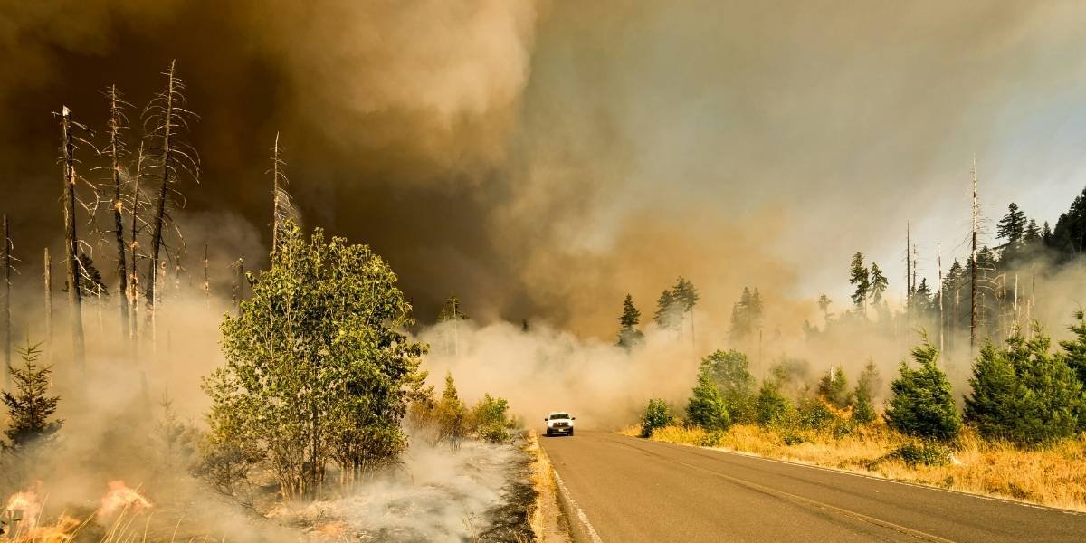
Fire smoke from the Woodside Fire pushed parts of Sonoma County into hazardous air-quality territory as crews worked to contain the 143-acre blaze near Timber Cove. The alert matters across the North Bay, where residents faced health precautions, evacuation orders and road closures. This report explains the fire’s status, smoke risks and official guidance.
Key Takeaways
- The Woodside Fire had burned 143 acres and was 30% contained as of Friday morning, July 31.
- Guerneville recorded hazardous air, while Sebastopol, Forestville and Santa Rosa reported unhealthy conditions.
- Evacuation orders remained active near Timber Cove, Salt Point State Park and other coastal areas.
- Highway 1 remained closed between Timber Cove Road and Stewarts Point-Skaggs Springs Road.
- Air officials advised residents to reduce smoke exposure and prohibited wood burning during the Spare the Air Alert.
The Woodside Fire created two linked emergencies across Sonoma County on Friday, July 31. Firefighters continued suppression work along the coast while a dense smoke plume moved inland and reduced air quality across parts of the North Bay.
The most serious readings were reported well beyond the fire perimeter. Guerneville reached the hazardous category, while Sebastopol, Forestville and Santa Rosa registered unhealthy air. Smoke also reached Marin County, Napa Valley and San Francisco, although conditions varied considerably by location.
Fire Smoke Sends Sonoma County Air Into Dangerous Categories
The Bay Area Air District extended a Spare the Air Alert through Saturday as fire smoke continued to affect Sonoma County and other parts of the region. The district forecast air quality ranging from unhealthy for sensitive groups to very unhealthy in the North Bay, with the most significant effects expected in Sonoma County.
Under the U.S. Environmental Protection Agency’s Air Quality Index, readings from 201 to 300 are classified as very unhealthy. Readings of 301 or higher are hazardous, a category associated with emergency health warnings because everyone is more likely to be affected.
Wildfire smoke contains fine particulate matter known as PM2.5. These particles can travel deep into the lungs and may cause coughing, wheezing, throat irritation, breathing difficulty or chest tightness. Children, older adults and people with heart or lung conditions can face greater risks, although hazardous readings may affect the broader population.
Air officials advised residents in smoky areas to remain indoors with doors and windows closed when possible. People without access to filtered indoor air were encouraged to use a cooling center or another public building with cleaner air, particularly if indoor temperatures became unsafe.
Residents traveling by vehicle were also advised to place ventilation systems on recirculation mode. The Air District said fireplaces, wood stoves, pellet stoves, fire pits and other wood-burning devices could not be used during the alert because they add particle pollution to already smoky conditions.
Because wind direction and fire activity can shift quickly, conditions were not uniform across the Bay Area. Officials urged residents to check neighborhood-level readings through the EPA Fire and Smoke Map rather than rely only on a regional forecast.
Crews Reach 30% Containment After Overnight Operations
CAL FIRE reported that the Woodside Fire had burned 143 acres and reached 30% containment by Friday morning. The wildfire began at 1:43 p.m. Thursday near Highway 1 in Timber Cove. Its cause remained under investigation.
Three night-flying helicopters conducted water drops while another helicopter provided aerial supervision. Ground crews worked through the night to strengthen containment lines, slow the fire’s spread and address hot spots.
By Friday morning, 320 personnel were assigned to the incident, along with 32 engines, four helicopters, five bulldozers, four water tenders and 14 crews. Additional firefighting aircraft were available as conditions allowed.
The scale of the operation reflected the challenges of working along a remote and heavily vegetated section of the Sonoma Coast. Regional agencies have also emphasized Bay Area wildfire preparedness, including coordination among local, state and federal rescue teams when evacuations, smoke exposure and difficult terrain place pressure on local resources.
Despite progress on containment, the fire continued to produce smoke that traveled far inland. A reduction in the fire’s spread did not immediately improve air quality because existing smoke remained near the surface in some communities while winds continued moving the plume.
No civilian or firefighter injuries had been reported as of Friday. Officials had also not announced confirmed structure losses at that stage of the response.
Evacuation Orders and Highway 1 Closure Remain Active
Evacuation orders remained in effect for Zone SON-1D1, Salt Point State Park, Stillwater Cove Regional Park, Ocean Cove Private Camp and the Timber Cove subdivision. Zone SON-1D2 remained under an evacuation warning.
An evacuation order indicates an immediate threat to life and requires residents to leave. A warning signals a potential threat and advises people who need additional time, including those moving pets or livestock, to prepare to leave or depart early.
Highway 1 remained closed between Timber Cove Road and Stewarts Point-Skaggs Springs Road. The closure limited traffic through the active response area and allowed emergency personnel to move equipment along the coastal corridor.
A temporary evacuation point was established at Laguna High School, formerly El Molino High School, at 7050 Covey Road in Forestville. Officials also directed residents who needed help moving animals to local emergency support services.
The incident highlighted the importance of emergency access and wildfire buffer planning in communities located beside forests, grasslands and other open spaces. Those measures do not eliminate wildfire danger, but they can support evacuation routes and provide responders with more room to operate.
For North Bay residents, the Woodside Fire remained both a coastal wildfire and a regional fire smoke event. The fire’s 30% containment marked progress, but hazardous and unhealthy readings showed that health effects could extend beyond the immediate burn area while smoke remained over populated communities.
Frequently Asked Questions
How Large Was the Woodside Fire?
The Woodside Fire had burned 143 acres as of Friday morning, July 31. CAL FIRE reported that crews had reached 30% containment after overnight suppression work.
Where Did the Fire Smoke Create the Worst Air Quality?
Guerneville reported hazardous air, while Sebastopol, Forestville and Santa Rosa recorded unhealthy conditions. Air quality varied across the North Bay as winds moved smoke away from the coastal fire.
Which Areas Were Under Evacuation Orders?
Orders covered Zone SON-1D1, Salt Point State Park, Stillwater Cove Regional Park, Ocean Cove Private Camp and the Timber Cove subdivision. Zone SON-1D2 remained under an evacuation warning.
What Should Residents Do During the Smoke Alert?
Air officials advised residents to remain indoors with windows and doors closed when smoke was present and to reduce strenuous outdoor activity. Residents were also told to monitor local conditions because fire smoke levels could change quickly.
Why Was Highway 1 Closed?
Highway 1 was closed between Timber Cove Road and Stewarts Point-Skaggs Springs Road because of the active wildfire response. The closure helped keep the public away from the incident area and preserved access for emergency crews.


